Boundary Survey: Why and When You Might Need One
Picture this: you’re standing in your backyard, the sun is setting, and you’re admiring where your little slice of the world ends and your neighbor’s begins. These boundaries might seem obvious, right? Just lines in the earth that show where one property ends and another begins. But here’s the twist – sometimes, these lines are as clear as mud. That’s where the superhero of the property world steps in: the boundary survey. Let’s dive into the nitty-gritty of why boundary surveys are a big deal and when you might find yourself needing one.
Understanding Boundary Surveys
Imagine you’re a detective, but instead of solving crimes, you’re on a mission to figure out where your land stops and your neighbor’s starts. This is exactly what boundary surveys are all about. A pro known as a surveyor uses their gear and brainpower, checking out old records and maps to solve this mystery.
When Do You Need a Boundary Survey?

Buying a Property
Dreaming of your new home and its big backyard? Before you get too cozy, you’ll want to know exactly where your new kingdom’s borders are. A boundary survey is your best friend here, ensuring you get every inch of land you’re paying for.
Building Something New
Got plans for a grand new deck or a cozy garden shed? You’ll want to be dead sure you’re not setting up camp on your neighbor’s patch. A boundary survey acts like a guide, making sure your dream project stays on your turf.
Developing Land
Thinking about dividing your vast estate into mini plots for houses or shops? Here, boundary surveys are crucial. They’re the rulers and pencils ensuring every piece of the pie is perfectly portioned according to the law.
Resolving Arguments
Ever bickered with your neighbor over whose side the old oak tree falls? A boundary survey can end such feuds by drawing the line, quite literally, between properties.
Following the Law
In some spots, getting a boundary survey isn’t just smart; it’s the law. It’s all about keeping things on the up and up, making sure everyone’s playing fair.
Why Do You Need a Boundary Survey?
Avoiding Problems
Understanding your property lines can dodge a heap of trouble, keeping peace with the neighbors and ensuring no one’s overstepping.
Saving Money
Though it might seem like an extra cost, a boundary survey can save you a bundle by avoiding legal drama or fixing boundary boo-boos down the line.
Feeling Secure
Knowing for sure where your property lines lie lets you kick back and enjoy your space without worry.
Following Rules
Just like in sports, knowing and following the boundary rules keeps the game fair and square for everyone involved.
Being Responsible
Opting for a boundary survey shows you’re serious about your property stewardship, ensuring everything’s correct and copasetic.
Common Steps in a Boundary Survey: A Closer Look
1. Research: The Detective Phase
Imagine a surveyor as a modern-day Indiana Jones, but instead of searching for lost artifacts, they’re diving into a sea of historical records, old maps, and legal documents. This step is all about piecing together the puzzle of your property’s past. They’re looking for any clues that can tell them where the original boundary lines were drawn. It’s not just about looking at documents; it’s about understanding the story they tell about your land. They may even interview previous owners or consult with local authorities to get a clearer picture. This groundwork is crucial because it sets the stage for everything that follows. It ensures that the surveyor’s findings are built on a solid foundation of historical accuracy.
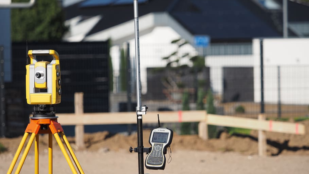
2. Field Work: The Treasure Hunt
With a detective’s hat on, the surveyor then becomes a treasure hunter, stepping onto your property with a trove of tools—think GPS devices, measuring tapes, and sometimes even drones. They meticulously walk your land, measuring distances and comparing what they see on the ground to the historical data they’ve gathered. This phase is hands-on and precise, as they look for natural landmarks, old markers, or even remnants of ancient fences that align with the documented evidence. It’s like connecting the dots, but instead of a picture, they’re revealing the true shape of your property.
3. Setting Markers: Making the Invisible Visible
After the surveyor has navigated the land and unraveled its secrets, they begin the task of marking the territory. Using stakes, flags, or sometimes even more permanent markers, they physically outline your property boundaries. These markers are not just placeholders; they’re a declaration, a way to say, “Here lies the edge of your domain.” This step is about turning the surveyor’s findings from an abstract concept into a tangible, visible reality everyone can see and understand. It’s a critical step for avoiding future disputes and ensuring that any development plans are within your rightful land.
4. Drawing Maps: Charting the Kingdom
With the exploration complete and the land marked, the surveyor then retreats to their realm to create a map of your property. This isn’t any ordinary map; it’s a detailed, to-scale representation of your property lines, complete with markers and notable features. Think of it as the final blueprint of your property’s boundaries. This map is crafted with precision and care, often using sophisticated software to ensure accuracy. It’s a document that not only serves as a record but also as a tool for planning, development, and resolving any boundary-related issues that might arise.
5. Sharing Results: The Grand Finale
The culmination of the surveyor’s journey is when they present you with the findings. You receive a detailed report that includes the map, descriptions of the boundary markers, and an explanation of how the conclusions were reached. This document is like a treasure map, revealing the exact extent of your land. It’s an essential tool for any property owner, providing clarity and confidence about where your property begins and ends. With this in hand, you’re equipped to make informed decisions about your property, secure in the knowledge of what’s yours.
This detailed journey from historical research to the placement of boundary markers underscores the critical role that boundary surveys play in property ownership. By following these steps, surveyors ensure that property boundaries are accurately identified, helping to prevent disputes and ensure peaceful coexistence among neighbors.
Conclusion:
Boundary surveys might seem wrapped in mystery, but at their heart, they’re about clarity and fairness. Whether you’re stepping into a new home, embarking on a building project, or simply wanting to know what’s yours, a boundary survey is your roadmap to peace of mind. So, next time you think about your property lines, remember, a boundary survey is more than just a formality; it’s the key to confidently owning and enjoying your space.

Leave a comment